Origins and Development of the Atlas of Drowned Towns
The project’s seeds were planted in Bob’s MA thesis from the University of Oregon (2005), later revised and published as Struggle on the North Santiam: Power and Community on the Margins of the American West, (Oregon State University Press, 2020). That thesis and book included a chapter on Detroit, Oregon, a drowned town to which Bob compared another drowned town, Hover, Washington, in a 2011 award-winning article for the Western Historical Quarterly.
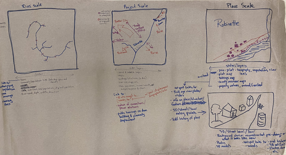
A grant from the Charles Redd Center for Western Studies at Brigham Young University supported research into displaced communities on the Snake River, and a Digital Projects for the Public Discovery Grant from the National Endowment for the Humanities supported a series of meetings with scholars, technology experts, and community members. Those meetings, conversations, brainstorming, and research led to the project’s Core Values, some initial design documents, and plans for developing a database and digital platform that could help recover and interpret the histories of inundated communities.
In 2022, Bob entered into a cooperative agreement with the US Army Corps of Engineers (USACE; agreement under Federal Award Identification Number W912HZ2220044) to develop the Atlas of Drowned Towns database and platform, along with community outreach and engagement efforts, focused on the USACE’s Willamette Valley Project in Oregon.