Three Gorges, China -- Documenting the World's Largest Dam-Induced Displacement
By McKenna Schmitt, Graduate Research Assistant (2025-2026)
Introduction
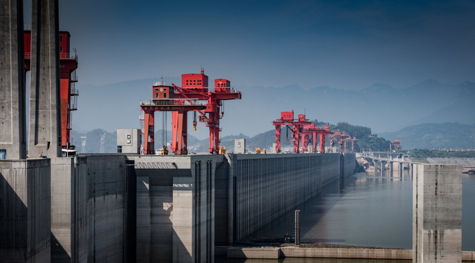
The Atlas of Drowned Towns was created to document communities displaced by large dam projects, with an initial focus on the American West. While that work has been extensive, it left a significant gap in understanding displacement as a global phenomenon. Expanding beyond the United States became necessary to fully grasp the scale of dam‑induced displacement worldwide. The Three Gorges Dam in China represents one of the most important cases for this broader perspective. As the largest hydropower project in the world by installed capacity, it is also one of the most impactful dam projects in modern history. Its construction displaced approximately 1.4 million people, far exceeding the scale of most projects documented in the American West (Tan, 2008). Including the Three Gorges in the Atlas helps illuminate the magnitude of global displacement and the cultural landscapes that are removed or inundated beneath reservoirs.
Life in the Three Gorges Before the Dam
Understanding displacement in the Three Gorges region requires understanding what life was like before inundation. Chetham (2002) describes the Yangtze River valley as a densely populated and culturally rich area where towns were closely connected to the river. Places such as Fengjie, Wushan, and Zigui had long histories dating back to 314 BCE. Fishing, agriculture, and river trade shaped daily life, and communities developed strong local identities over generations.
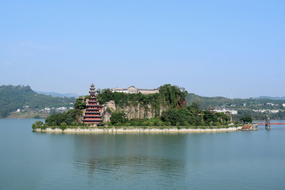
These towns were more than physical locations. They were places where people had deep social connections and shared histories. Cultural landmarks such as the Shibaozhai temple and riverbanks carved with poems held meaning that extended far beyond their physical presence. Chetham’s work shows that displacement meant losing a sense of place and heritage; something often missing from technical discussions of dam projects.
The Scale of Displacement
The Three Gorges Dam fundamentally reshaped how displacement is understood in the context of large dams. Compared to projects in the American West, where displacement often affected thousands at most, the Three Gorges involved entire urban centers and regional populations numbering in the millions. Historical neighborhoods were moved and landmarks were constructed as islands in the reservoir to preserve. The difference is not only quantitative but qualitative. It required highly coordinated, government‑led resettlement efforts that reshaped social, economic, and environmental systems across a vast area (Jackson & Sleigh, 2000; Tan, 2008).
The displaced towns documented in the Atlas of Drowned Towns map include:
- Zigui
- Fengjie
- Badong
- Kaixian
- Shennongjia
- Wanxian
- Wushan
- Zhongxian
- Dachang
- Fengdu
- Yunyang
- Changshou
- Fuling
- Additional displaced population (placeholder entry)
These towns were identified primarily through Chetham (2002). There are likely more unnamed villages and settlements that were not documented in the available sources, but these represent the towns that could be confirmed within the research timeline.
Cultural and Social Loss
Much of the existing literature on the Three Gorges Dam focuses on policy, economic outcomes, or environmental change. While these perspectives are important, they often overlook the cultural and social losses experienced by displaced communities. Studies like Heming and Rees (2000) and Jackson and Sleigh (2000) describe relocation policies and socio‑economic impacts, but they do not fully capture what it meant for communities to lose their homes, landscapes, and histories.
Kirchherr et al. (2019) suggest that these types of losses are often minimized in official government accounts. By documenting these towns in the Atlas, this project helps bring attention back to the places and communities that existed before the dam. It shows that displacement is not just about relocation, it is also about the loss of connection to place.
Challenges in Documenting Large-Scale Displacement
A major challenge in adding the Three Gorges region to the Atlas is the lack of a comprehensive way to represent the full scale of displacement. The Atlas relies on “Town” entries, which require specific attributes such as a town name, dates of establishment and inundation, and population displaced. This system does not translate well to large international cases like the Three Gorges, where displacement occurred across vast regions and included many smaller settlements that were never formally recognized as towns.
Many villages or neighborhoods were not documented in official government records due to their size or administrative status. As a result, it is difficult to account for all displaced populations. To address this limitation, a “placeholder” town entry was created to represent the difference between the number of people displaced in the known towns and the total estimated population displaced by the project.
There is also significant variation across sources in estimating the total number of people displaced, with figures differing widely and in some cases continuing to change over time. This inconsistency highlights broader challenges related to data availability, reliability, and standardization in documenting large‑scale displacement.
Conclusion
The Three Gorges Dam highlights the global scale and complexity of dam‑induced displacement. It demonstrates the importance of expanding the Atlas of Drowned Towns beyond the United States and adapting its methods when engaging with large‑scale international projects. This interpretation contributes to that effort by documenting displaced communities, emphasizing cultural loss, and acknowledging the limitations of available data. Expanding international research in the future will help strengthen the Atlas as a tool for understanding displacement worldwide and ensure that the histories of communities affected by projects like the Three Gorges are not forgotten.
References
- Chetham, D. (2002). Before the deluge: The vanishing world of the Yangtze’s Three Gorges. Palgrave Macmillan.
- ECNS. (2015, November 24). "Photos: Three Gorges scenery and surrounding areas." ECNS. http://www.ecns.cn/visual/hd/2015/11-24/81301.shtml#nextpage.
- Heming, L., & Rees, P. (2000). "Population displacement in the Three Gorges reservoir area of the Yangtze River, central China: Relocation policies and migrant views." International Journal of Population Geography, 6(6), 439–462.
- Jackson, S., & Sleigh, A. (2000). "Resettlement for China’s Three Gorges Dam: Socio-economic impact and institutional tensions." Communist and Post-Communist Studies, 33(2), 223–241.
- Jim, C. Y., Yang, F. Y., & Wang, L. (2010). Social-ecological impacts of concurrent reservoir inundation and reforestation in the Three Gorges region of China. Annals of the Association of American Geographers, 100(2), 243–268.
- Kirchherr, J., Ahrenshop, M.-P., & Charles, K. J. (2019). "Resettlement lies: Suggestive evidence from 29 large dam projects." World Development, 114, 208–219.
- Sanxia China. (n.d.). Shibaozhai. Sanxia China. https://en.sanxia-china.com/shibaozhai/a37466.html.
- Tan, Y. (2008). Resettlement in the Three Gorges Project. Hong Kong University Press.
- Tripadvisor. (n.d.). "Chongqing Three Gorges Dam." Tripadvisor. https://www.tripadvisor.com/Attraction_Review-g661500-d1814854-Reviews-Chongqing_Three_Gorges_Dam-Wushan_County.html
- Xinhua News Agency. (2020). "2020 PR album 3" Xinhua News Agency. https://fms.news.cn/swf/2020_PRalbum/2020_PRalbum3/index.html